In early 1886 the Municipal Council reserved Section 38 of Cairns (five acres enclosed by Sheridan, Grove, Sachs and Gatton Streets) as a pound for stray animals and it was referred to as the Pound Reserve for the next fifty years. A common complaint in the early settlement of Cairns was strays, with dogs biting people, cows mooing outside homes, unregistered goats eating laundry and horses camping under verandas.
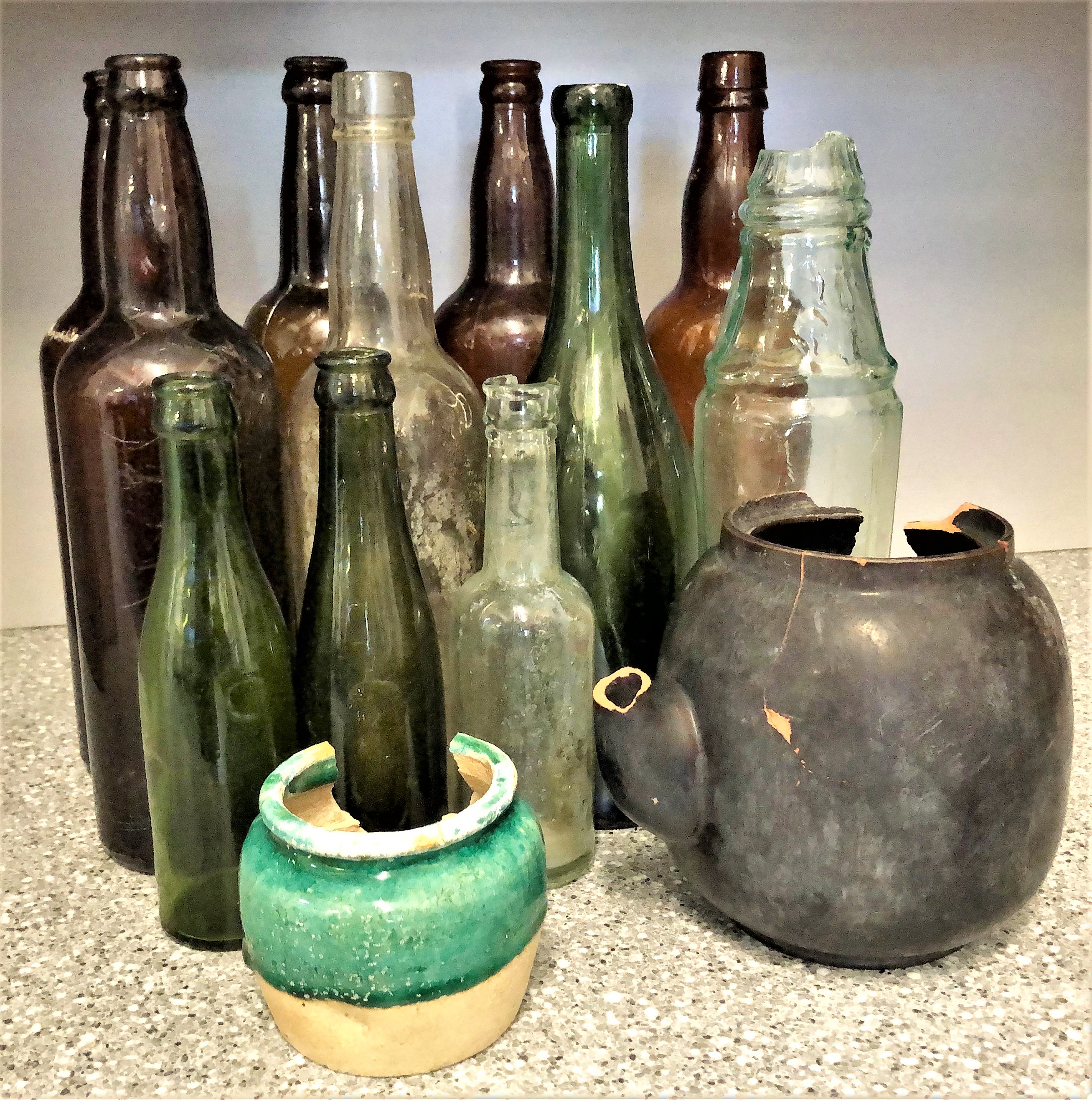
In 1900 the reserve was used as a camping ground with tents and humpies. The Pound Reserve was also used in 1908 as a dumping ground for 'night soil' in the absence of proper sewerage facilities which were not connected until 1961.
After 1916, the High School Reserve had to be prepared for a future school. That included turning the Sachs Street side, essentially from Grove Street to Gatton Street, into a rubbish tip for landfill before children could attend the adjacent school.
In 1922 Doctor Elkington wrote from Brisbane to the Council and requested a site for a Commonwealth Health Laboratory. The Council surrendered half an acre of the Pound Reserve at the corner of Grove and Sheridan
Streets. Mayor Hoare argued this site was near the hospital and added that it was vital for research into tropical diseases (Cairns was in the midst of a malarial outbreak at the time).
1936 the Director of Education, stated that more sports ground would be required because of an intended new High School building (A Block) and Intermediate School.
"It is highly desirable that the land described as Pound Reserve R272, City of Cairns, be secured for sports purposes for the High and Intermediate School and Technical College and for use in the future for educational purposes."
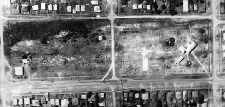
Aerial view of the High School and the reserve in 1937 with Gatton Street cutting through the middle. The Commonwealth Laboratory is in the bottom left corner and a sand ridge runs parallel to Grafton Street with some land still to be cleared in the top left corner. As with other sections, such as Norman Park, these dunes had to be cleared of vegetation, levelled and filled to make the ground uniform. The High School was divided into two fenced sections. On the right are the buildings while, to the left of them, was the sporting field. The strip in the sporting field was a tennis court completed in 1926 by Tom Fitchett and Pat Plunkett. It had a foundation of red gravel covered in two inches of ant-bed and was enclosed with wire netting. Annie Wallace wrote in Euroka that the Sub Juniors always sighed when they were kept in because others could claim the court first,155 while Reverend Robert Edward Bacon congratulated Cairns High School in an address at Aplin Street Methodist Church for playing such a healthy game as tennis.
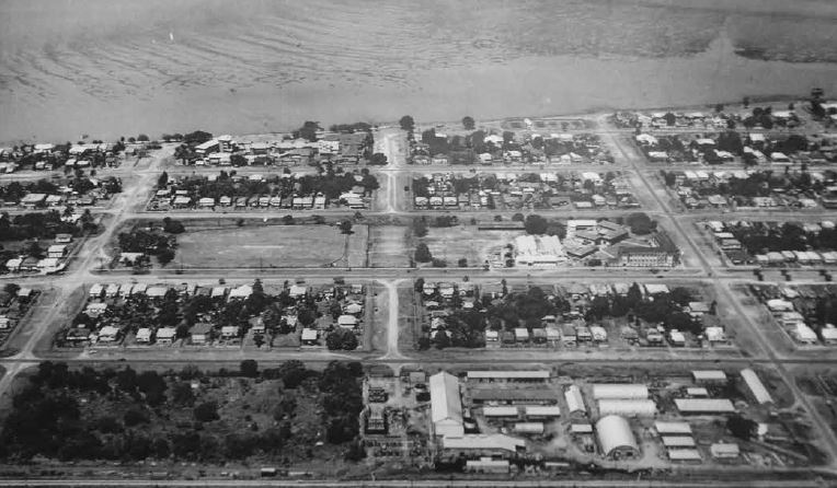
Below is the former reserve in March 1955 after being cleared and joined to the High School In August 1958 Crosswell suggested that the Department also acquire the Commonwealth residence, which was being used by a doctor at the time.
In 1989 the Federal Government tried to sell the 2020 square metre block as a prime development site. The school was able to prevent the sale and was given the land in November 1989.
The erection of a new fence around the school oval in 2013 confirmed these reports with rubble from the 600 millimetre post holes revealing a high concentration of glass refuse at the old dump.
With the 2020 construction of Bou-wa: The Centennial Hall, more glassware and earthenware was unearthed.